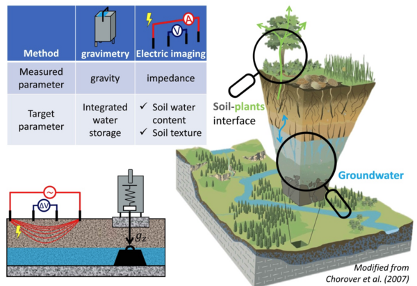
How can geophysics help characterize groundwater dynamics and water fluxes at the soil-plants-atmosphere interface?
The critical zone is the thin layer of the Earth's surface that supports most of the terrestrial biosphere. It is a coupled system involving the atmosphere, hydrosphere and biosphere, whose dynamics are largely controlled by the flow of water between these compartments. Characterizing the dynamics of water within the critical zone would allow us to quantify the availability of water resources for the biosphere, and to assess the impact - current and future - of climate change on the functioning of ecohydro-systems. By their nature, soils and aquifers are not easily accessible and are highly spatially heterogeneous. Characterizing the spatiotemporal dynamics of water stocks therefore represents a real challenge, which hydro-geophysical methods help to solve by providing spatially distributed data acquired noninvasively. This presentation will demonstrate the contribution of hydrogravimetry and complex electrical resistivity tomography to the characterization of water dynamics within a headwater catchment and a wine-growing agro-system.

