Multiple lumped hydrogeological models to highlight local driving forces: case of the Upper Rhine alluvial aquifer
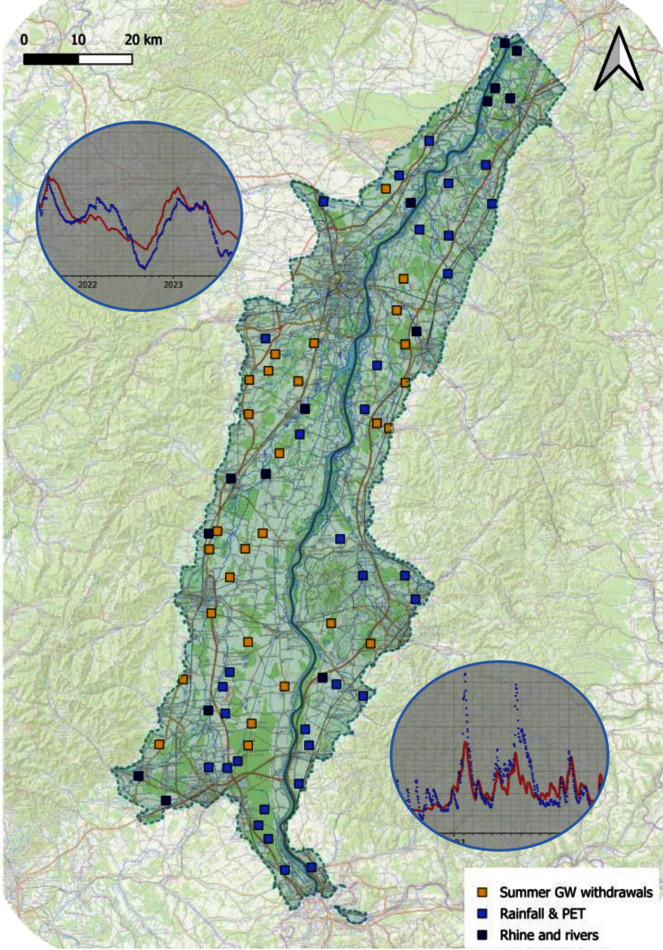
This study presents a spatially distributed modeling approach based on lumped hydrogeological models applied across approximately 100 locations within the Upper Rhine alluvial aquifer, as part of the Interreg GRETA project. The objective was to identify dominant hydrological drivers influencing groundwater dynamics at local scales. Different model configurations were tested per location, including simple rainfall- recharge and evapotranspiration-based setups, models incorporating surface water interactions, and configurations accounting for summer groundwater withdrawals through a specifically developed proxy. Results reveal that the most appropriate model structure varies across the aquifer, highlighting the spatial heterogeneity of dominant processes. In particular, areas strongly influenced by river-aquifer exchanges or anthropogenic pressures such as seasonal pumping require more complex configurations to adequately simulate observed groundwater behavior. A key aspect of this work lies in the adaptation of a modeling tool originally designed for valley-bottom aquifers (where stream-aquifer coupling is dominant) to a large alluvial aquifer system characterised by complex human-water interactions. This study underscores the importance of localised model structures to capture site-specific forcing mechanisms. The findings provide insights for water resource management in highly exploited and interconnected systems, and stand as a basis for future modelling work in a context of extreme events (global change).